Data has massive value today, but what is also important is the tool to simplify and understand data. Aware of this fact, dtac has decided to partner with the Chulalongkorn University’s (CU) Faculty of Architecture and Boonmee Lab in developing Mobility Data Dashboard as a platform for interested groups to explore more about domestic tourists’ behaviors.
dtacblog recently sat down with Asst. Prof. Dr. Nattapong Punnoi, a key man behind the Mobility Data Dashboard. While he is a full-time lecturer at the faculty’s Department of Urban & Regional Planning, he also heads the “Project to Study Thai Tourists’ Mobility and Concentration during COVID-19 Situation”. According to him, Mobility Data Dashboardprovides insight on tourism data at three levels:
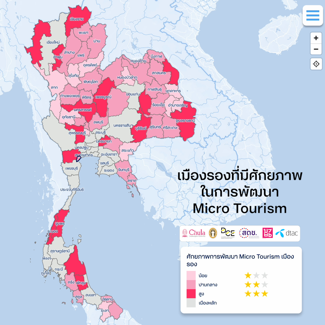
1. Cluster level: The dashboard shows secondary-city clusters to guide each secondary city about which neighboring provinces it should partner with and develop tour routes and tourism activities that best suit tourists’ behaviors. Generally, tourists visit several provinces in the same trip. Central government agencies thus should use the cluster-level information to boost the efficiency of tourism-campaign designs.
2. Provincial level: This provides insights on provincial tourism trends, including the profiles of its inbound and outbound tourists. The profiles specify gender, age, and hometown of tourists. As a result, policymakers and tour operators will have a clearer picture of target tourists, which will lead to more efficient promotional campaigns. The profiles of outbound tourists are useful in promoting tourism and developing interprovincial tour packages. The profiles of inbound tourists, meanwhile, enable local government agencies and enterprises to develop activities and attractions that match major tourist groups.
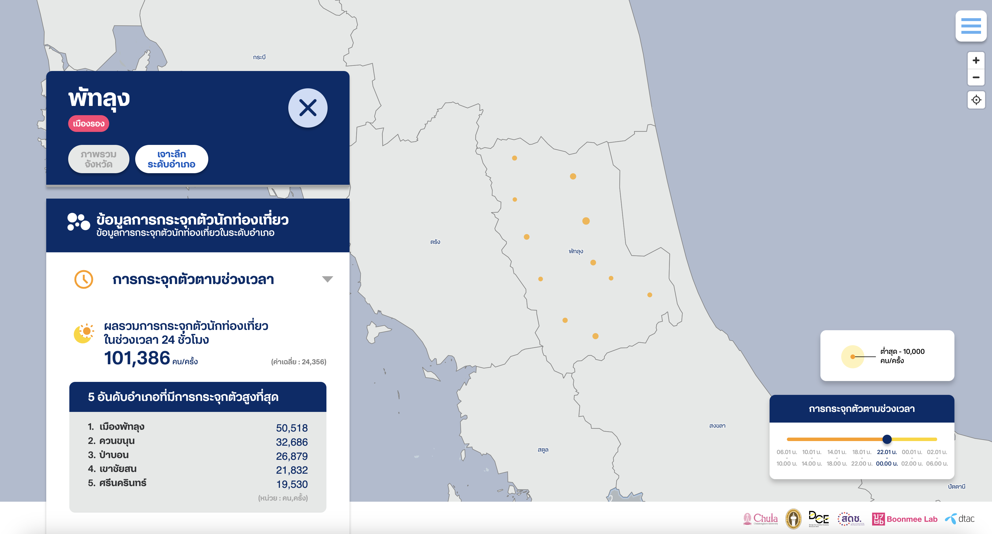
3. District level: Local government agencies and enterprises can find out the volume and patterns of tourists concentrating in each district for different time periods here. Such information paves the way for the development of products and services that respond better to tourists’ needs and behaviors.
In addition, information on the concentration of tourists in each period reflects how tourism in neighboring provinces is related. The development of local tourism activities and tour routes thus will be easier and more efficient. For example, Phetchaburi’s Mueang district is outstanding for its food. Tourists therefore usually visit the area during the day to enjoy delicious meals. The province’s Cha-am district, meanwhile, features both famous restaurants and hotels. Tourists therefore are concentrated in the district during nighttime. Ban Laem district, for its part, is known for fisheries and mangrove forests. Tourists usually visit Ban Laem in the evening on their way back home. When the prominent features of these districts are analyzed with mobility data, it is possible to design tourism activities that best promote each district of the province.
“Information at such three levels creates a new paradigm for tourism data, because it gives more details and higher data accuracy for the development of tourism activities, products, and services for the needs of target groups,” Asst. Prof. Dr. Nattapong said. However, he reckoned that mobility data still has some limitations in understanding tourists’ behavior. To address this concern, relevant public and private sectors could share information, particularly transaction data, attitudes / comments, pollution, or adverse impacts, which would assist with data integration to further enable the formulation of concrete sustainable tourism policies that suit local context even better.

Asst. Prof. Saranya Siangarom, who works for the Architecture for Creative Community Research Unit of the CU’s Faculty of Architecture, said Thailand’s tourism policy had been mainly developed based on perspectives of stakeholders in each area. Such approach is good because the development is in line with local needs. However, it frequently resulted in promoting unimaginative tourism activities that fail to respond to the fast-changing needs of target groups. The development of tourist cities for both economic output and sustainable social development will have to consider the relationships of tourism activities, local context, and locally-driven public relations. Only with such development can there be a balance between local-development direction and the needs of visitors.

Both university lecturers have recommended a City Branding concept based on local resources and consumers’ behaviors. In their view, such approach promises to attract tourists from other areas and promote their interactions with local people, local resources, local products, and local services in a way that generates positive impacts on local communities on a sustainable basis.
“Mobility data represents one big group of important data, because they offer insights into tourists’ behaviors and pave the way for relevant parties to efficiently conduct City Branding,” Asst. Prof. Saranya said.

Samut Songkhram: City of Three Waters
Asst. Prof. Dr. Nattapong pointed out that Mobility Data Dashboard could be used for Samut Songkhram’s tourism development. By nature, Samut Songkham is a city of three waters namely freshwater, brackish water, and saltwater. It holds an abundance of crops and diverse ways of life. Due to its close proximity to Bangkok, this province is highly appealing to tourists. However, most tourists to Samut Songkhram in the past 10 years were Chinese who limited their activities to visiting a floating market. Such tourist behaviors mean tourism benefits have not been fully distributed to local farmers and entrepreneurs. Worse still, Samut Songkhram’s tourism income has dropped the sharpest during COVID-19 crisis of all Thai provinces because foreigners could not come to the country during the period.

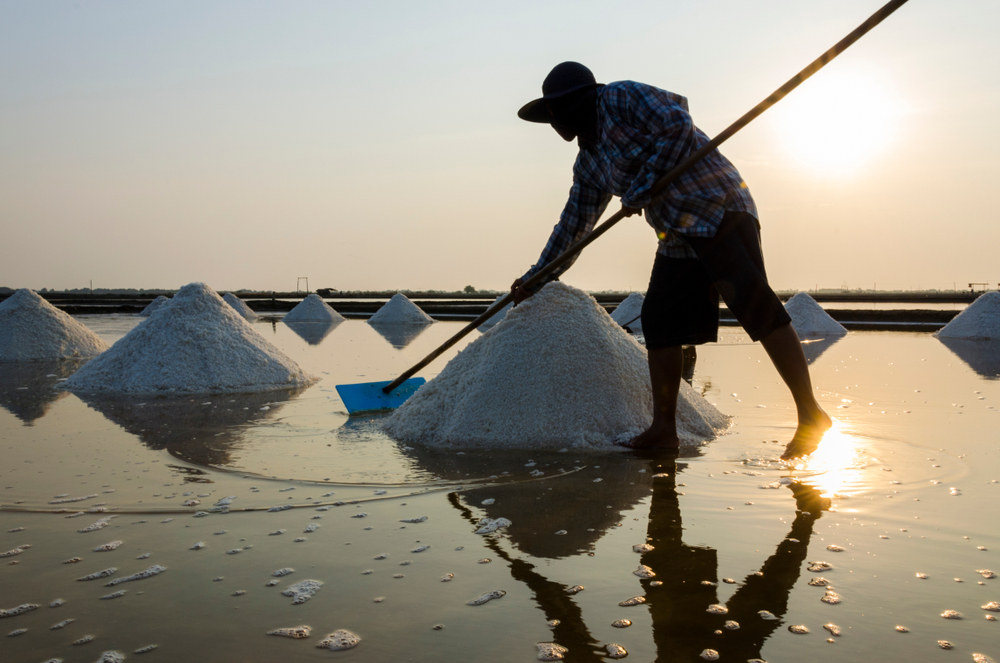
Mobility data reveal that most of Samut Songkhram’s tourists have travelled from Bangkok. Those of working age come to the province mostly on weekends. Day trips account for a big percentage of trips to Samut Songkham. With the current road network, most tourists drop by Mae Klong town before heading to major attractions in other districts. When such data is considered alongside the fact that “experiential tourism” has become popular among people, especially those of working age, there is a possibility of developing Samut Songkhram’s tourism potential based on its existing resources and identity. As city people love camping with friends or family members and getting close to nature on holidays, Samut Songkhram apparently can capitalize on its mangrove forests, salt fields, riverside ways of life, fruit orchards, and farmland in tourism development. For instance, it is possible to develop community tourism in which tourists learn about local lifestyles, taste local food, enjoy riverside music performances, produce handicrafts, and try agricultural activities in Samut Songkhram. Local-carbon tourism can also be fostered in the province, with tourists encouraged to explore its area on bicycle, cruise through a salt field, and slide a board over muddy ground at Don Hoi Lod, eat at Mae Klong, stay overnight in a camping style in Amphawa, and go fruit-tasting at various orchards in Bang Kon Tee.

Phatthalung: Province of Mountains, Forests, Paddy Fields, and Water
Despite being a secondary province, Phatthalung is abundant in natural resources and geologically diverse. Because it is landlocked, it is different from all other southern provinces. To its east is the Songkla Lake. To its west are mountains. Locals’ way of life is closely associated with freshwater agriculture, which is not prominent in seaside southern provinces. The distinctive “identity” of Phatthalung, however, has drawn a constant flow of tourists throughout the past five years. Mobility data shows tourists in Phatthalung mainly come from neighboring provinces. The biggest group of tourists are either of working age or the elderly who usually make a day trip. In the morning, tourists are mostly concentrated around Thale Noi and Songkhla Lake. Later in the day, tourists are concentrated in districts with famous attractions and community markets.

Asst. Prof. Saranya cited a CU survey in saying that the majority of tourists in Phatthalung were travelling with their family members and interested in indulging in the province’s local culture. Phatthalung, as a result, should realize use its distinctive landscape and ways of life to its benefits. Its forests, mountains, freshwater fisheries, Sang Yod paddy fields, shadow plays, and Manohra traditions can all contribute to its tourism. If tourism activities are well developed, economic benefits can be distributed comprehensively across the province. For example, Phatthalung may consider developing running trails through mountainous areas, promoting local dishes that are made of local ingredients, and highlighting freshwater fisheries. As tourists are spread across the province, unwanted impacts from high concentration of tourists in a few areas will be curbed.

“Locals normally know the value and outstanding stuff in their hometown. But it is important to study information on the demand side as well. If they know more about tourists, upgrading the commercial potential of local wisdom based on local identity will be possible. Last but not least, if relevant parties work together seriously, the use of such information will help create more jobs, conserve cultural heritages, and protect natural resources on a sustainable basis. We believe that data-based decision-making will foster stronger collaborations at local level,” Asst. Prof. Saranya said.
Any organization interested in using Mobility Data Dashboard for tourism development can contact Asst. Prof. Nattapong and Asst. Prof. Saranya of CU Faculty of Architecture or dtac.


